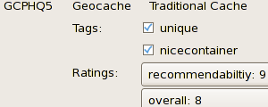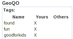
and share them!
GeoQO Data on Cache Pages


The geoqo ("GEO - KO") software is a Free! geographical waypoint management software set that lets you manage your geocaches and other types of geographical data.
| Handles Data From | Cache Density Plots | Special Geocaching for TomToms |
|---|---|---|
 |
||
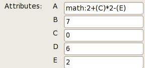
| Solve Geocache Puzzles | Tag, Rate your finds and share them! |
Use the Firefox Plugin GeoQO Data on Cache Pages |

|

|

|
The following table displays links to the documentation for various plugins that come with geoqo. The documentation for each plugin describes what it does and how it works with examples of using it.
| Import | Search | Modify | Display | Export | Everywhere |
|---|---|---|---|---|---|
gpx zip loc dir base64 wigle system create average project |
cache waymark geodining wigle waypoint ident log attribute attr rating tag set track file returnhome gps any mem |
solved gctodiff rewrite setattr tag rate makepuzzle delete classify symbol translate distance sortby track diff limit only drop dropexisting load mem |
help count list show map top10 sets attributes stats gui/list gui/show bounds graph/find graph/placed dump |
gpx loc map kml system html mem |
mem |